
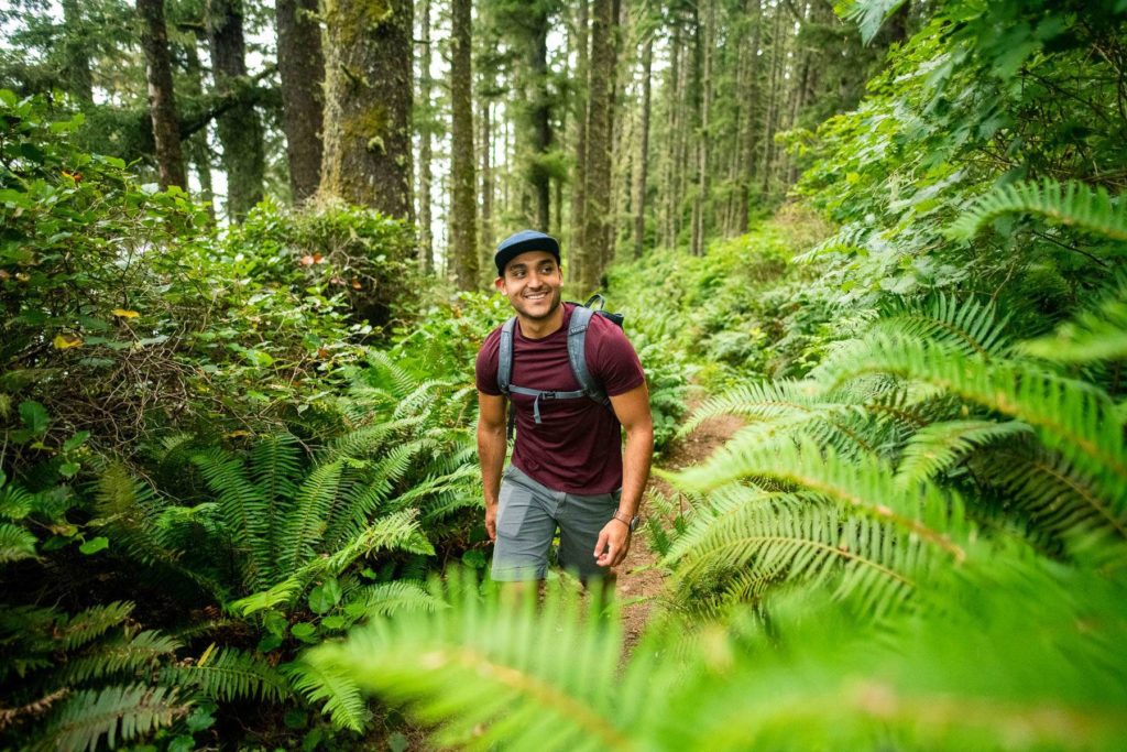
With diverse landscapes dotting every corner of the state, the hardest part about hiking in Washington might be deciding where to start. Whether you’re looking to traverse rugged coastline, jagged peaks, alpine wildflower meadows, or ancient lava flows, get inspired for your next adventure with these scenic Washington State hikes.
Safety & Responsible Visitation
Hiking conditions can vary greatly depending on the region, season, and elevation. Always check conditions, and make sure you’ve picked a hike that matches your skill level. Keep these additional tips in mind for a safe and enjoyable experience. Learn more about recreating responsibly in Washington.
Ten Essentials and Proper Gear: Ensure you have the Ten Essentials, such as plenty of water, navigation aids, sun protection, and first aid supplies when hiking in Washington. Check elevation gain, trail length, and more to make sure you’re aware of the difficulty level and have the supplies needed to stay safe.
Weather and Trail Conditions: Snow is often present at higher elevations until early summer. Visit the National Weather Service and the Washington Trails Association for conditions before heading out. Hiking poles, traction cleats, waterproof boots, layers, and water are especially important at higher elevations from fall through spring.
Leave No Trace: Follow the seven Leave No Trace principles, which include staying on marked paths, packing out all waste and trash, and keeping your distance from wildlife.
Emergency Services: When in doubt, call 911. The King County Search and Rescue Association encourages hikers to err on the side of caution and call for assistance as soon as possible. Familiarize yourself with these tips for what to do if lost before hitting the trail.
Washington State Hikes
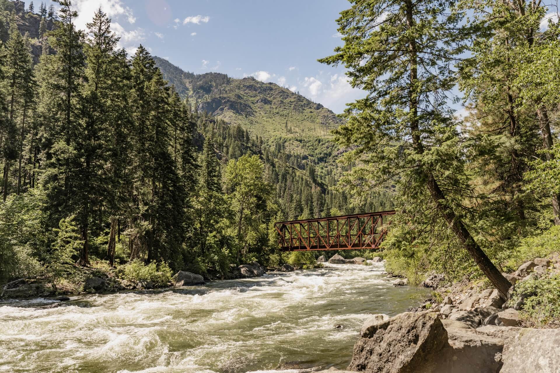
Lewis River Falls, Gifford Pinchot National Forest
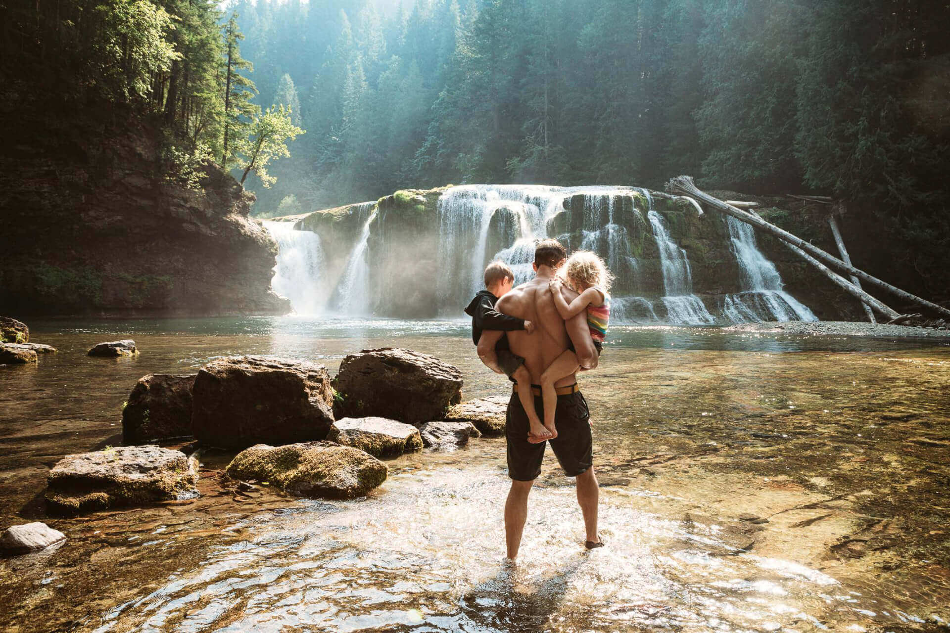
8.8 miles | 450 feet elevation gain
Good for: Waterfalls, forest views
Nestled in Gifford Pinchot National Forest near Mount St. Helens, the Lower Lewis River Falls Trail heads through an old-growth forest of cedar and Douglas fir before arriving at its namesake cascade, which tumbles roughly 40 feet down into the Lewis River. The pool below the falls is a popular swimming hole in the summer months, with bracingly cold water. Those looking for a longer hike can extend to Middle or Upper Falls.
Travel Tip: You’ll need a Lewis River Recreation Area Ticket if visiting between mid-June and early September. Hikers must also pay a daily vehicle fee or have a valid pass, such as a Northwest Forest Pass or an America the Beautiful pass.
Also See: 10+ Scenic Waterfalls
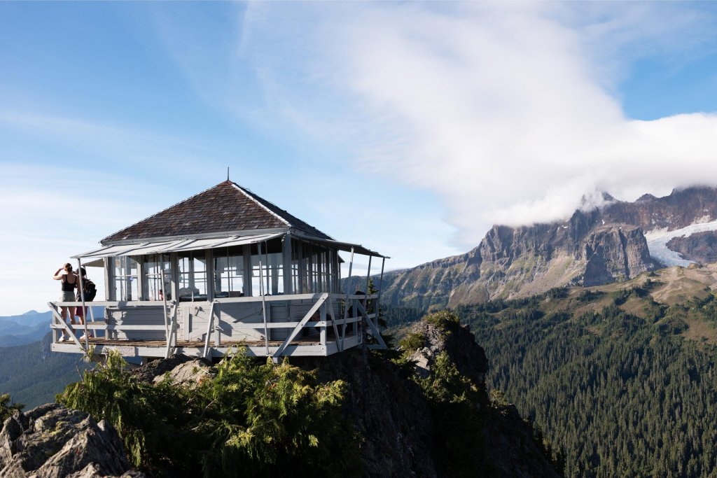
Mount Fremont Lookout Trail, Mount Rainier
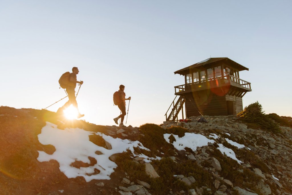
5.6 miles | 1,200 feet elevation gain
Good for: Views of Mount Rainier
The Mount Fremont Lookout Trail, usually accessible from July through September, begins from the Sunrise Visitor Center in Mount Rainier National Park. From there, it ascends to a fire lookout tower built in 1934. Views include Grand Peak, Skyscraper Mountain, and Mount Rainier’s snow-capped summit. Early-summer wildflower displays line the trail, and mountain goats frolic in nearby meadows. A National Park pass is required.
Travel Tip: In 2025, timed entry reservations are required for the Sunrise Corridor daily between 7 a.m. and 5 p.m. from July 11 through Sept. 1. From Sept. 2 to mid-October, reservations are required for weekends and holidays. Learn more about reservations and visiting Mount Rainier National Park.
Cape Disappointment Trail, Long Beach Peninsula
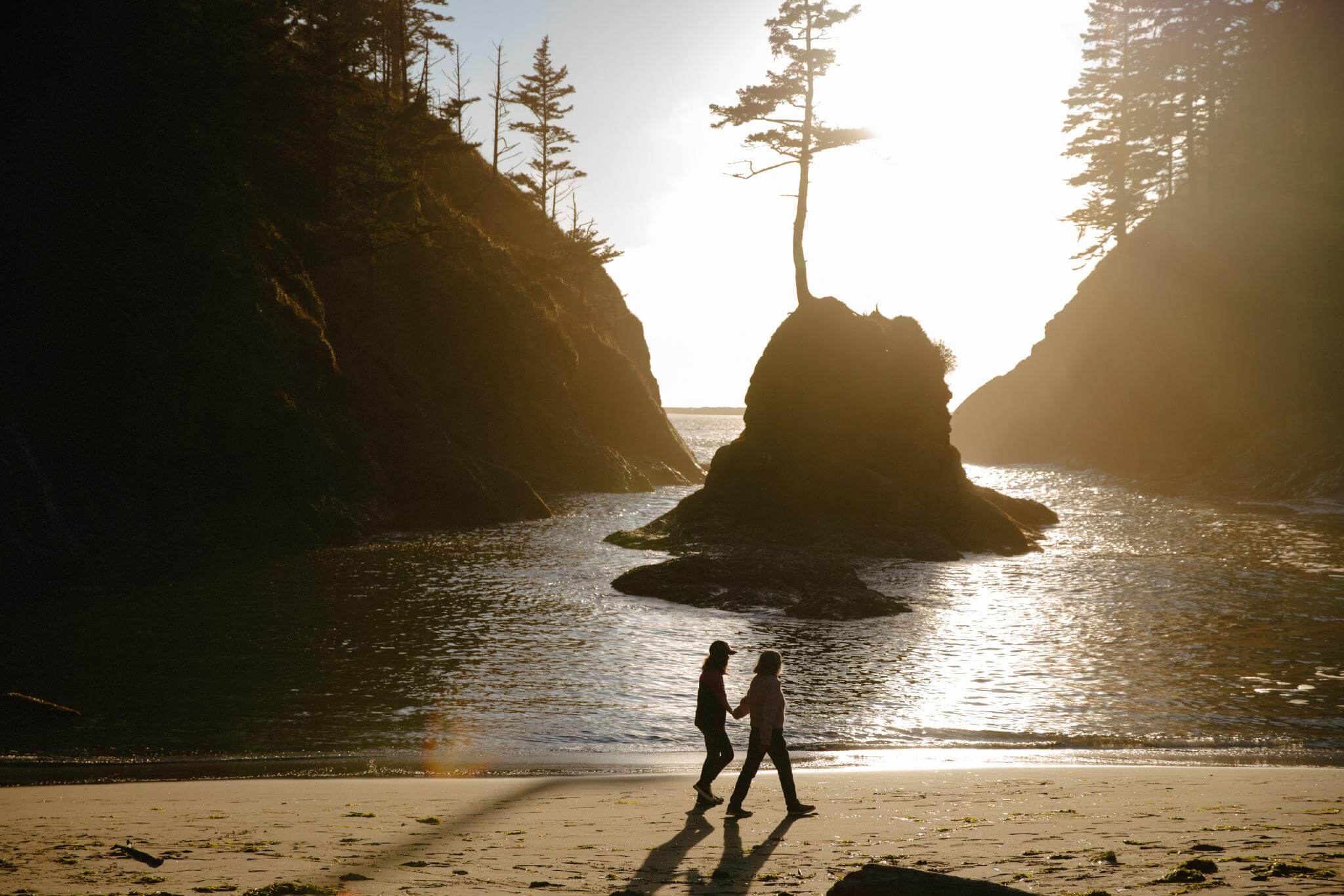
2.4 miles | 500 feet elevation gain
Good for: Lighthouses, beach access, families
Cape Disappointment State Park on the Long Beach Peninsula packs plenty of wow into its short, family-friendly trail to the scenic Cape Disappointment Trail. The trail winds its way past photogenic Dead Man’s Cove to a lighthouse built in 1856, offering sweeping views of the Pacific Ocean. Don’t miss the Lewis and Clark Interpretive Center, which tells the story of the Corps of Discovery. A Discover Pass is required.
Bowl and Pitcher at Riverside State Park, Spokane
2.1 miles | 165 feet elevation gain
Good for: Families, river views
Named for the volcanic rocks at the heart of the trail, the Bowl and Pitcher Hike sits just west of Spokane at Riverside State Park. The footpath provides an up-close look at the geologic forces that shaped this corner of Washington, with views of steep cliffs, basalt outcroppings, and smooth boulders in the Spokane River. A Discover Pass is required.
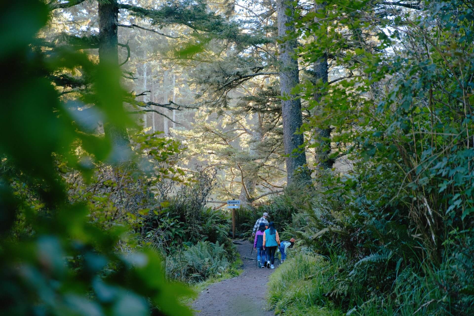
Ozette Triangle, Olympic National Park
9.4 miles | 100 feet elevation gain
Good for: Coastal views, rain forests
Sample some of Olympic National Park’s varied ecosystems with a stroll on the magical Ozette Triangle Hike. The trek encompasses Lake Ozette, one of the largest lakes in Washington, as well as misty groves of western red cedar and wide-open ocean views across Cape Alava. A National Park pass is required.
Also See: Things to do on the Olympic Peninsula
Mount Constitution, Orcas Island
6.7 miles | 1,500 feet elevation gain
Good for: Island views
You could drive to the top of Mount Constitution in Moran State Park on Orcas Island, but the path less traveled rewards hikers with views of Rosario Strait, the nearby San Juan Islands, and the North Cascades. Take the Mount Constitution Trail via Mountain Lake to reach the peak’s summit. A stone replica of a watchtower sits at the top, where visitors can enjoy a panoramic view of the surrounding islands and even the distant North Cascades. A Discover Pass is required.
Grand Ridge Trail and Obstruction Point, Hurricane Ridge
15 miles | 3,100 feet elevation gain
Good for: Mountain views
The Grand Ridge Trail from Obstruction Point heads into the heart of Olympic National Park and affords views in every direction. On a clear day, that includes nearby Olympic Mountain peaks, the Strait of Juan de Fuca, the Cascade Range, and meadows covered in wildflowers. Snow is common at higher elevations in spring, so plan your hike between mid-July and mid-September for a snow-free trip. A National Park pass is required.
Cape Flattery, Olympic Peninsula
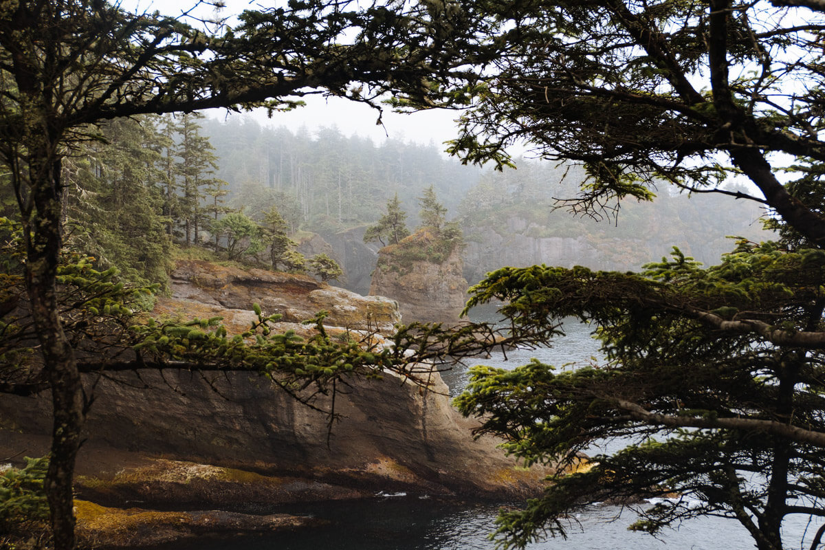
1.5 miles | 200 feet elevation gain
Good for: Ocean views, wildlife viewing
Cape Flattery sits at the most northwestern point in the contiguous United States, where a mellow hike leads to four viewing decks that show off rock formations and a deactivated lighthouse on Tatoosh Island. Lucky hikers can sometimes spot wildlife like gray whales and sea lions. The Makah Tribe manages the trail, and a Makah Recreation Permit is required.
Also See: Where to View Wildlife in Washington
Cowiche Canyon Conservancy, Yakima Valley
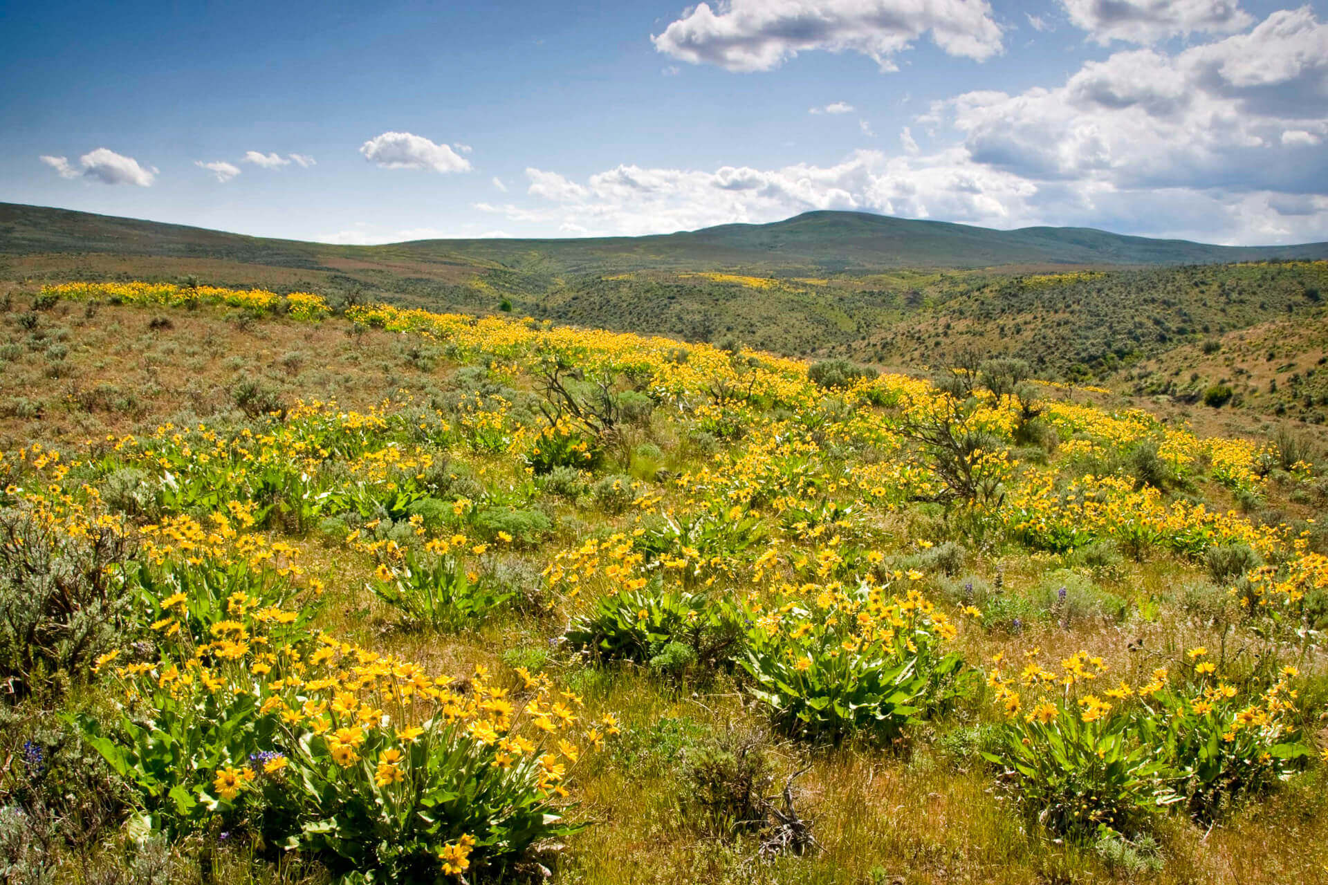
6 miles | 100 feet elevation gain
Good for: Families, wildflowers
The largely flat Cowiche Canyon Trail stretches six miles through its namesake gorge and hosts new delights all year long. Colorful wildflowers cover the canyon’s hillsides in spring, summer’s sunny skies make it easy to spot songbirds, aspen leaves turn bright yellow every fall, and winter means solitude while enjoying fresh snow. The Conservancy’s extensive trail network is easily reachable from the Yakima Valley for those exploring Wine Country.
Also See: Colorful Wildflower Hikes in Washington
Beacon Rock, Columbia River Gorge
2 miles | 600 feet elevation gain
Good for: River views, unique trail
The 848-foot-tall Beacon Rock, the onetime core of a long-extinct volcano, sits along the Columbia River and is one of the more unique Washington State hikes thanks to its series of switchbacks, boardwalks, and handrails that follow the basalt column to its summit. There, you’ll savor sweeping views that include Cape Horn, Bonneville Dam, and other iconic sites. A Discover Pass is required.
Spruce Railroad Trail, Lake Crescent
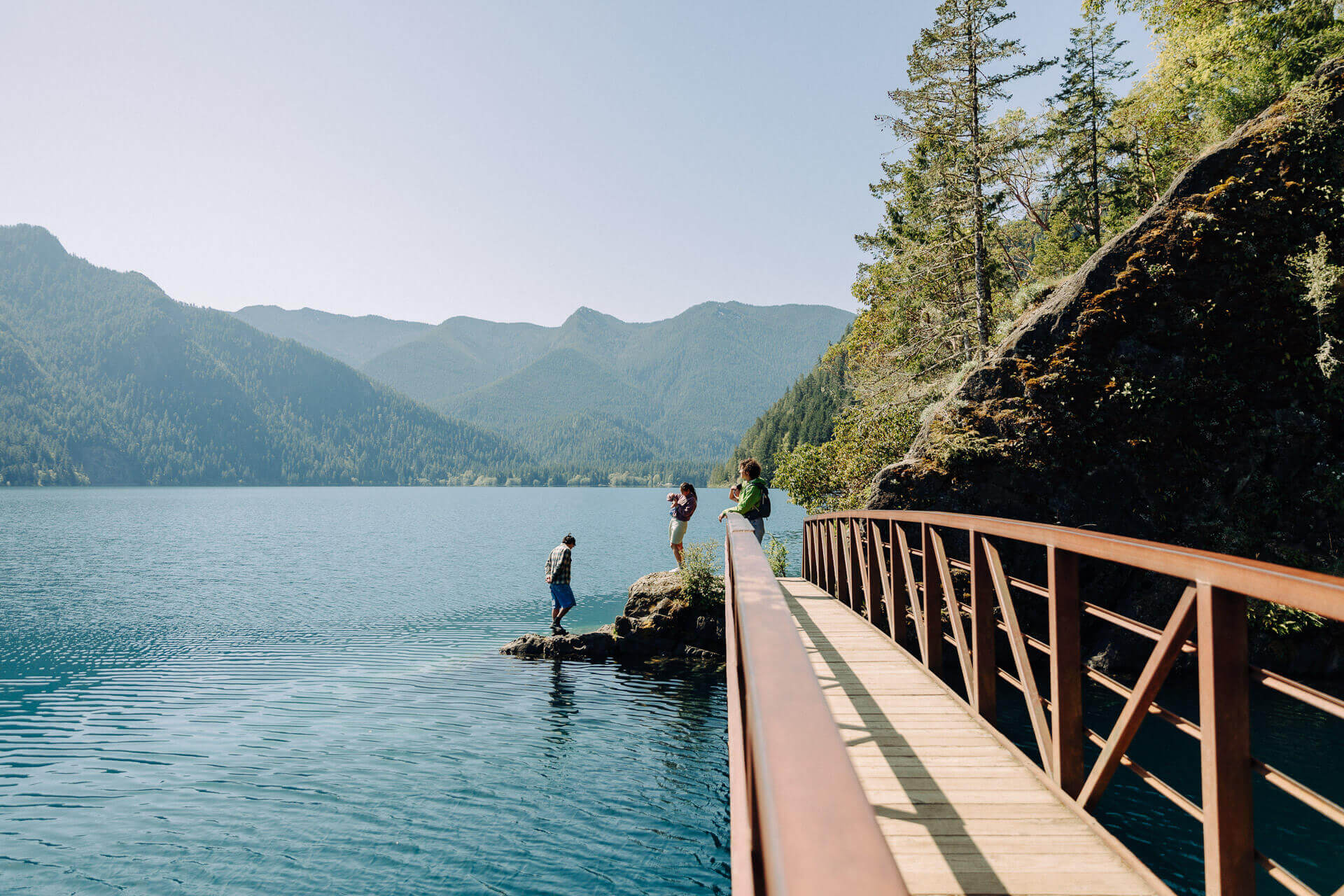
8 miles (flexible) | 250 feet elevation gain
Good for: Lake views
The idyllic Spruce Railroad Trail runs along the sparkling shore of Lake Crescent in Olympic National Park. Mostly flat, this is a great option for families looking to stretch their legs or dip their toes in the water. After just one mile, you’ll come to a tunnel where you can veer off on a dirt trail to a picturesque bridge. Marvel at the crystal clear pool known as the Devil’s Punchbowl before continuing the hike or heading back the way you came.
Also See: Less-Crowded Hikes in Olympic National Park
Park Butte Lookout, North Cascades
7.5 miles | 2,200 feet elevation gain
Good for: Mountain views, wildflowers
Hike into the heart of the North Cascades on the Park Butte Hike. After heading through forests and meadows that light up with bright blooms every summer, you’ll arrive at a fire lookout built in 1932. From there, the Twin Sisters, Mount Baker, and several other mountain peaks dominate the horizon. Hikers must pay a daily fee per vehicle or have a valid pass.
Stehekin River Trail, Lake Chelan
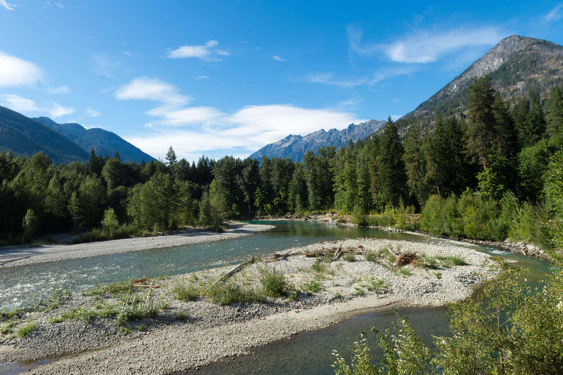
7.6 miles | 100 feet elevation gain
Good for: Families, fall color, mountain views
Take a relaxing stroll along the Stehekin River Trail, accessible via the Lady of the Lake ferry from Chelan. The trail mostly follows the banks of the Stehekin River while showing off mountain views, forested ponds, colorful foliage, and spawning salmon in fall. The small community of Stehekin also offers access to other trails in eastern North Cascades National Park.
Lake Ingalls, Alpine Lakes Wilderness
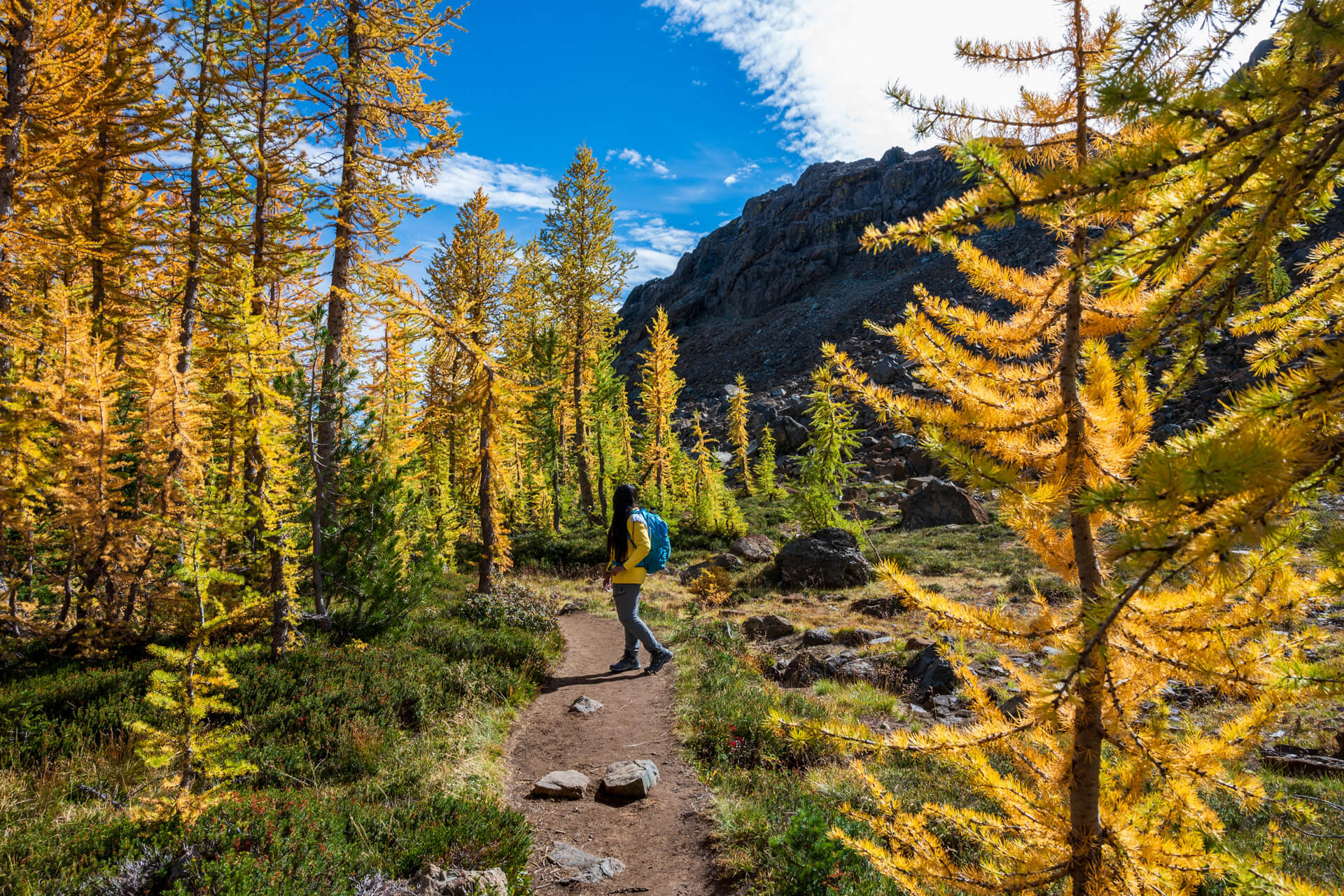
9 miles | 2,500 feet elevation gain
Good for: Fall color, wildflowers, lakes
The star of the Lake Ingalls hike is a crystal-clear basin surrounded by jagged peaks, but the trail delivers a steady stream of impressive sights. Summer wildflowers cover Alpine Lakes Wilderness meadows, mountain goats can be glimpsed in the highlands, larch trees turn bright yellow in fall, and the likes of Mount Stuart and Ingalls Peak tower over it all. Hikers must pay a daily fee per vehicle or have a valid pass, such as a Northwest Forest Pass or an America the Beautiful pass.
Tip: This is a popular trail in summer and for fall foliage, so aim to visit mid-week and arrive early.
Also See: Fall Color Hikes, Drives, and More
Butte Camp Trail, Mount St. Helens
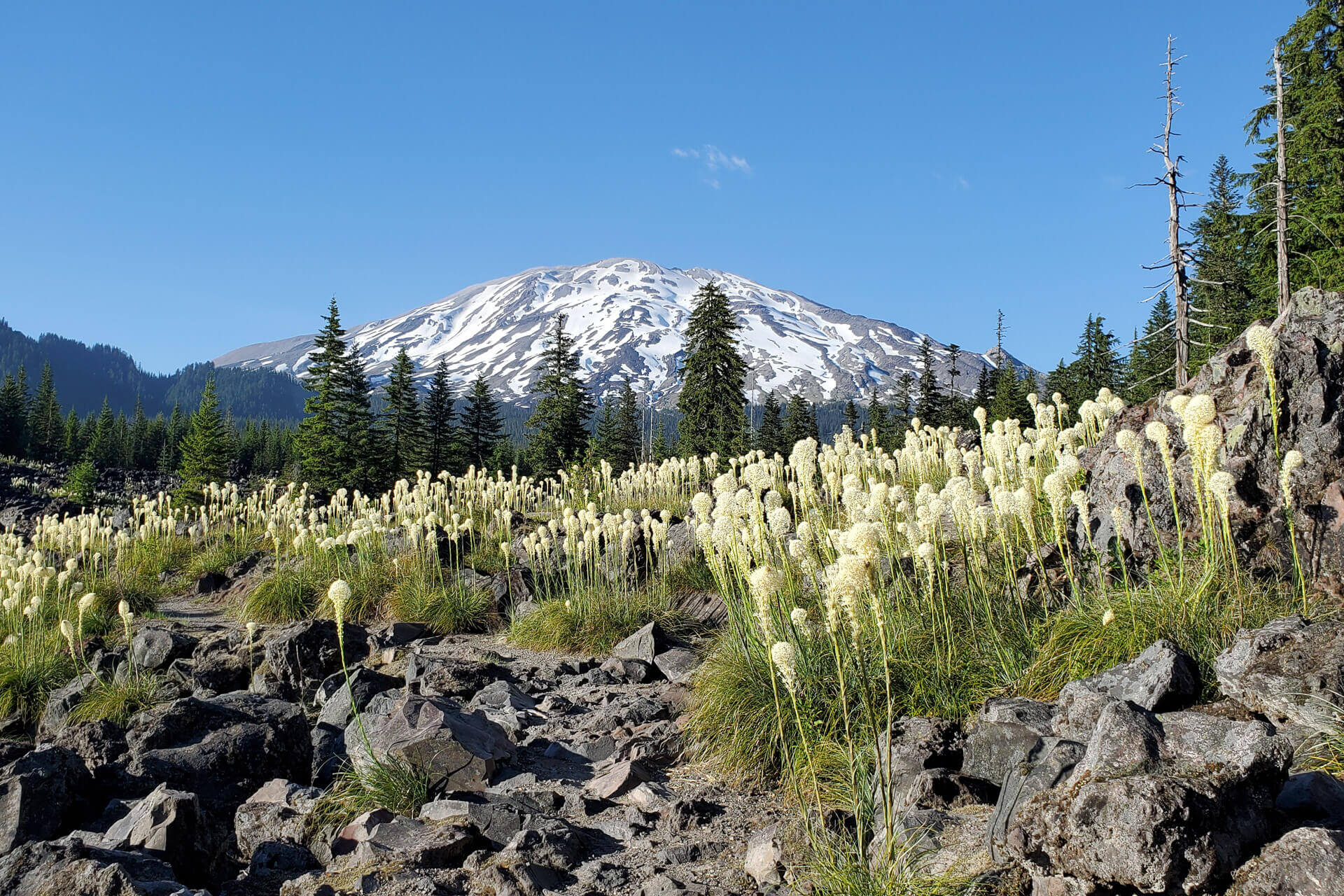
8 miles | 1,700 feet elevation gain
Good for: Mountain views, wildflowers
A variety of alpine landscapes awaits along the Butte Camp Trail on the south side of Mount St. Helens. Walk through groves of lodgepole pine, rugged lava flows, and meadows covered with beargrass and other wildflower blooms. A viewpoint at the end looks out over a few mountain peaks and the snowy slopes of Mount St. Helens. Hikers must pay a daily fee per vehicle or have a valid pass.
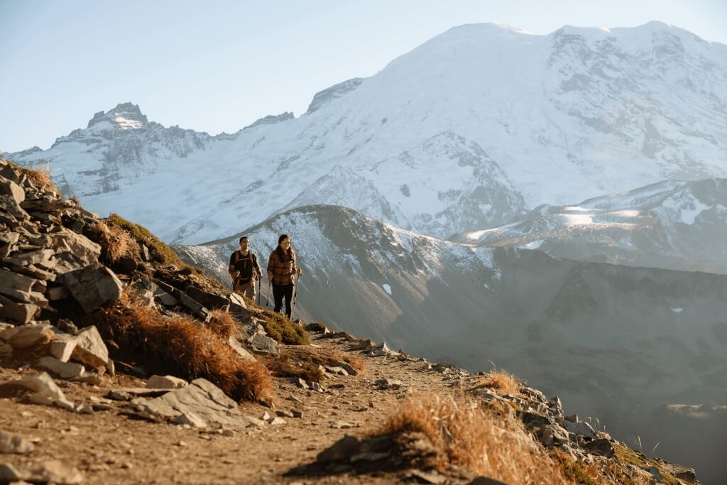
Reflection Lakes, Mount Rainier
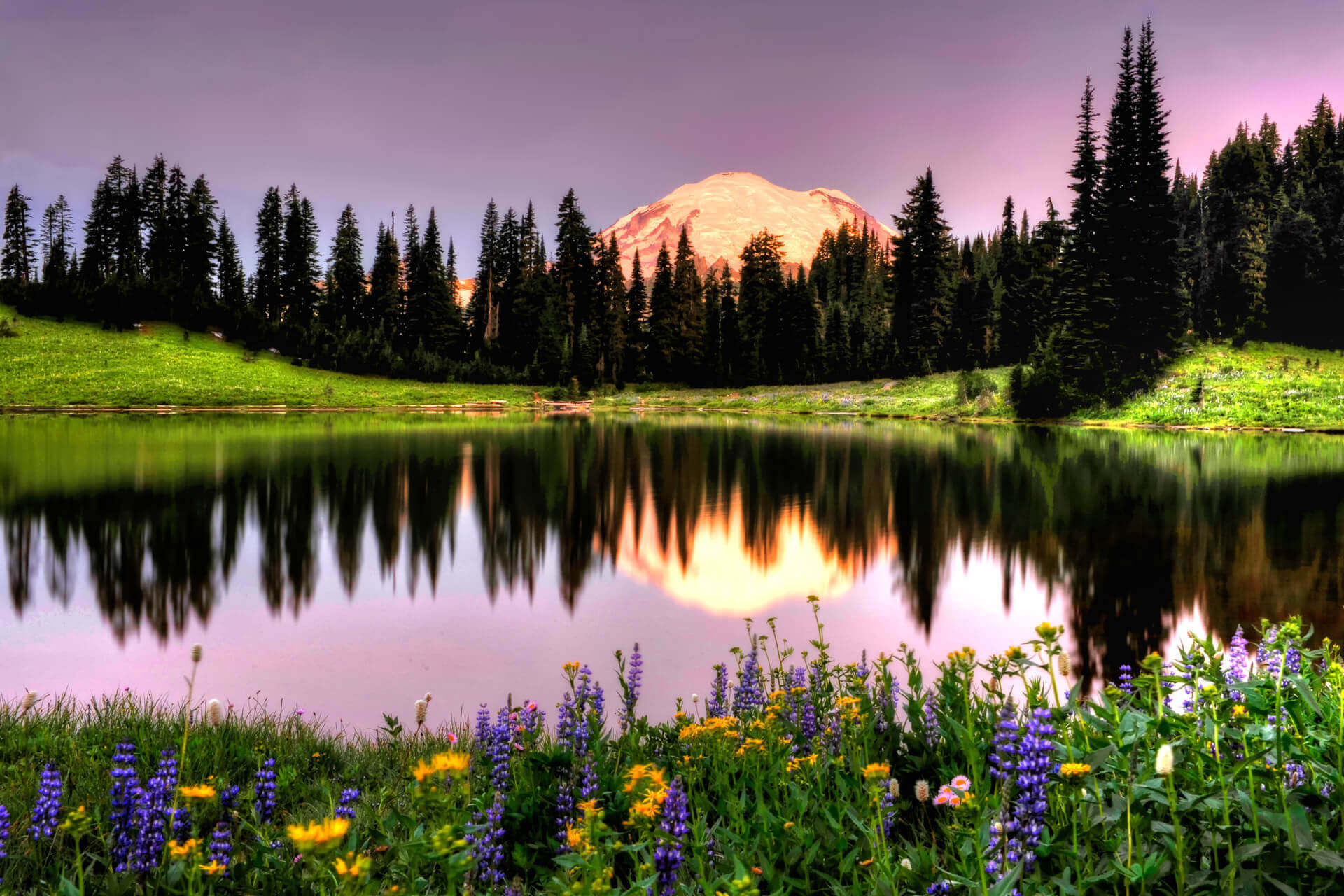
2.75 miles | 410 feet elevation gain
Good for: Mount Rainier views, lakes, fall color
Just southeast of the Paradise District in Mount Rainier National Park, Reflection Lakes is named for how the mountain’s iconic peak appears in the still waters of the ponds. The Reflection Lakes loop trail follows the lakeshore and heads into the surrounding forests. Wildflower blooms arrive in August, and fall foliage adds pops of color in late summer and early autumn. A National Park pass is required.
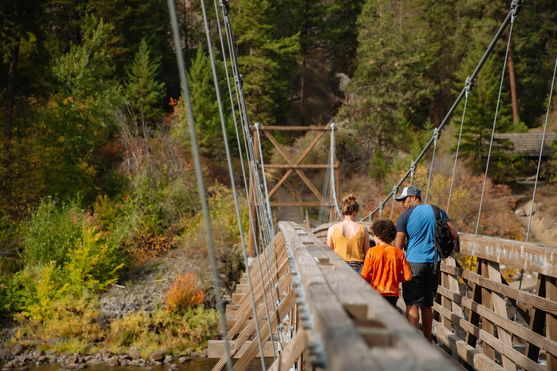
Susie Stephens Trail, Methow Valley
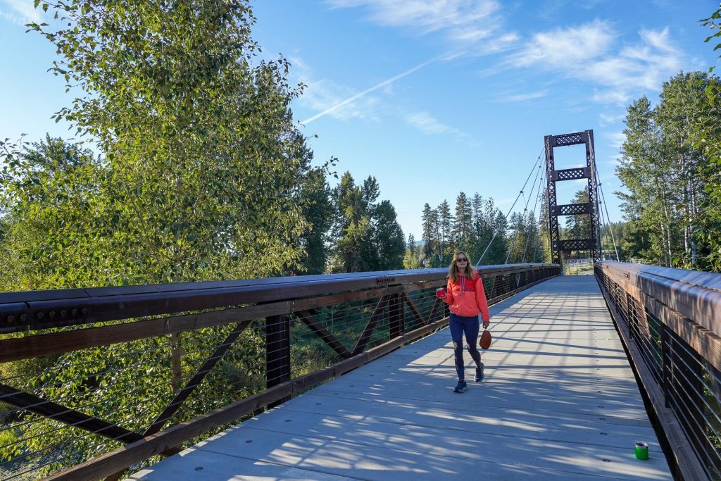
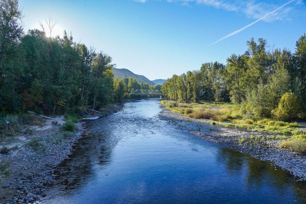
2.3 miles | 65 feet elevation gain
Good for: Families, river views
Savor Methow Valley views without leaving town along the Susie Stephens Trail. The paved, multi-use path heads between the southern edge of Winthrop and the compact community’s Wild West-inspired downtown core. Along the way, it crosses the Methow River on a pedestrian bridge, affords views of raptors and other wildlife, and shows off the Cascade Range foothills.
About the Author
Matt Wastradowski is a travel writer, guidebook author, and lifelong resident of the Pacific Northwest. He has written about the great outdoors, craft beer, and history for Northwest Travel & Life, REI, AAA’s Via magazine, and other publications.
Featured Image Photo Credit: Jan Wieser