Come winter, snow envelopes the state’s peaks, alpine meadows, and high-elevation lakes, beckoning snowshoers to grab a thermos of hot cocoa and hit the trails. From mountain trails that showcase mind-blowing vistas to snow-hushed river valleys, get ready to experience some of the best snowshoeing in Washington.
Whether you’re an experienced snowshoer or just starting out, there’s a trail for every skill level. If you don’t have your own gear, no problem. Rentals are readily available throughout the state.
Snowshoeing in Washington
The following routes are generally at low risk for avalanches, but it’s always a good idea to check the Northwest Avalanche Center forecast before heading out. Note that most listings use distances and elevations from the Washington Trails Association.
Gold Creek Pond, Snoqualmie Pass
2.8 miles | 10 feet elevation gain
Gold Creek Sno-Park, Sno-Parks permit required
Difficulty level: Easy
The flat terrain makes Gold Creek Pond an excellent snowshoeing trail for families and beginners, with an easy one-mile cruise around a snow-covered pond. Its location on top of Snoqualmie Pass provides stunning Cascadian peak panoramas. If you want to extend the adventure, check out other connecting trails. This area is popular, so get there early or go mid-week to avoid crowds. The road to the trailhead, Forest Road 142, isn’t plowed, but you can park along Forest Road 4832. Depending on your parking spot, it can be a half mile or more to the trailhead, so calculate that into your mileage.
Wenatchee Crest Trail, Cle Elum
6 miles | 400 feet elevation gain
Blewett Pass Sno-Park, Sno-Parks permit required
Difficulty level: Easy-Moderate
Starting high up on Blewett Pass in the Okanogan-Wenatchee National Forest, this ridgetop out-and-back snowshoe trail doesn’t have much elevation gain but affords expansive views of Glacier Peak, Mount Rainier, the Teanaway Mountains, and the Stuart Range — all the way from Miller Peak to the Peshastin Valley. Later in the season, this route sees more crowds on weekends as the snow at lower elevations melts.
Also See: Cozy Winter Getaway Destinations
Artist Point, Mount Baker
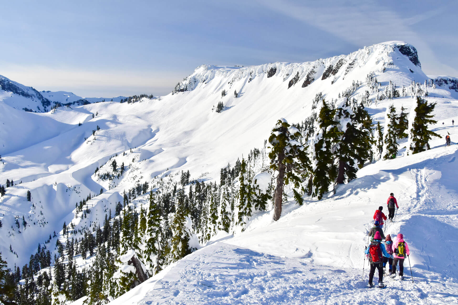
4 miles | 1,000 feet elevation gain
Heather Meadows/Mount Baker Ski Area overflow, free
Difficulty level: Moderate
Some consider Artist Point the most scenic viewpoint in the state, and it’s easy to see why. The North Cascades’ jagged, glacier-laden peaks crowd the horizon, including Mount Baker, Mount Shuksan, Whitehorse Mountain, and Sloan Peak. While not an overly lengthy route, some sections are steep, making this a nice option for experienced snowshoers.
Always consult the Northwest Avalanche Center forecast before you visit, as some of the route goes through avalanche terrain. If it’s snowing or fogged in, make sure someone in your group has route-finding skills.
Travel Tip: The final section of Mount Baker Highway to Artist Point closes each winter. Start the trail near the restrooms at the Heather Meadows parking lot at the Mount Baker Ski Area. Get directions.
Another nearby option that’s great for beginners is White Salmon Road. This 5-mile roundtrip has only 450 feet of elevation gain. Start at the Salmon Ridge Sno-Park (permit required). Walk along the Nooksack River Valley and soak in views of the mountain peaks if the skies are clear.
Cooper River, Salmon le Sac
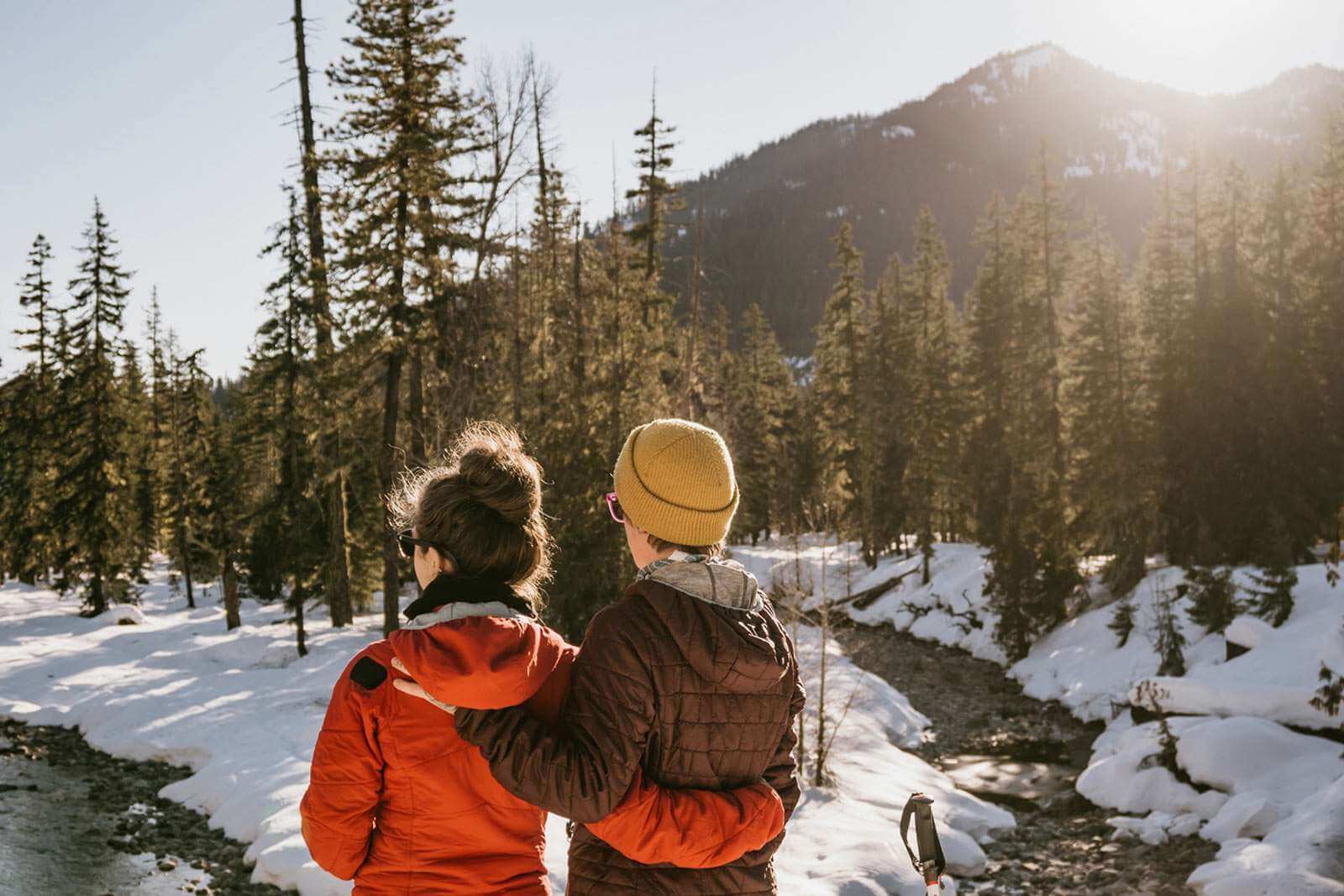
8 miles | 400 feet elevation gain
Salmon de Sac Sno-Park, Sno-Parks permit required
Difficulty level: Moderate
This out-and-back trek tours a river valley and old-growth forests of cedar, white pine, Douglas fir, and vine maple. The gently rolling trail is quiet outside of peak weekend times and allows snowshoers to observe many bird species and other wildlife, as well as enjoy the sound of the river. Turn around at pristine Cooper Lake, which is also a great spot for lunch. Note that the trailhead is about a mile from the Sno-Park parking lot.
Also See: Winter Getaway in the Cascade Mountains
Hurricane Ridge, Olympic Peninsula
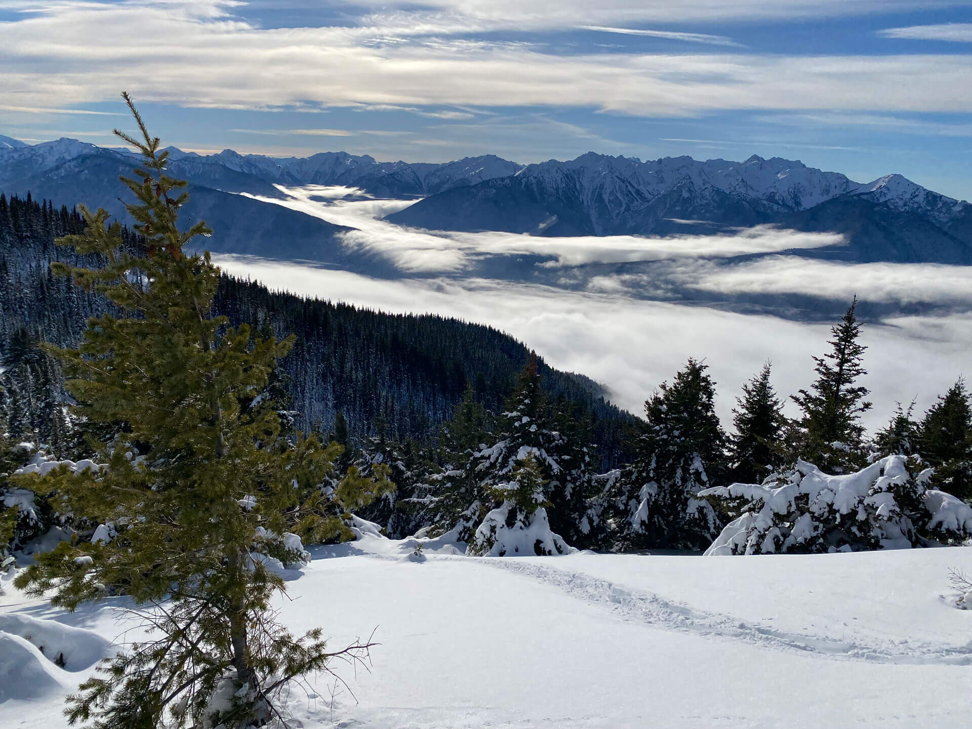
6 miles | 800 feet elevation gain
Hurricane Ridge, National Park Pass required
Difficulty level: Moderate
Hurricane Ridge is considered by many to be one of the top scenic snowshoe trails in Washington. This exposed ridgeline trail offers 360-degree views of Mount Baker, Mount Olympus, Glacier Peak, the Olympic Range, Puget Sound, and the Strait of Juan de Fuca. After your adventure, be sure to explore nearby Port Angeles or Port Townsend to the east.
Travel Tip: In winter, Hurricane Ridge Road is only open to traffic Friday-Sunday and some holidays, so time your trip accordingly. Check road conditions before you go. If visiting on a Saturday, consider taking the shuttle from Port Angeles. Operated by Olympic Hiking Co., the shuttle departs in the morning and returns by mid-afternoon. Advanced online bookings are required.
Skyline Lake, Leavenworth
3 miles | 1,100 feet elevation gain
Stevens Pass northern parking lot, free
Difficulty level: Moderate
This short, rigorous climb from Stevens Pass lands snowshoers at an incredible frozen lake basin with spectacular views of Big Chief and Cowboy Mountains, as well as the Alpine Lakes Wilderness. Continue around the lake to the gap on the ridge’s northwest side (do not cross the lake, as it may not be frozen) for even more dazzling views. The vista opens and showcases the Enchantments, Glacier Peak, Nason Ridge, Mount McCausland, and many more. This extra jaunt adds a little more climbing, but it’s worth it. Snowshoers fancy hitting this trail early season route because of the high elevation snow levels.
Sun Mountain Snowshoe Loop, Methow Valley
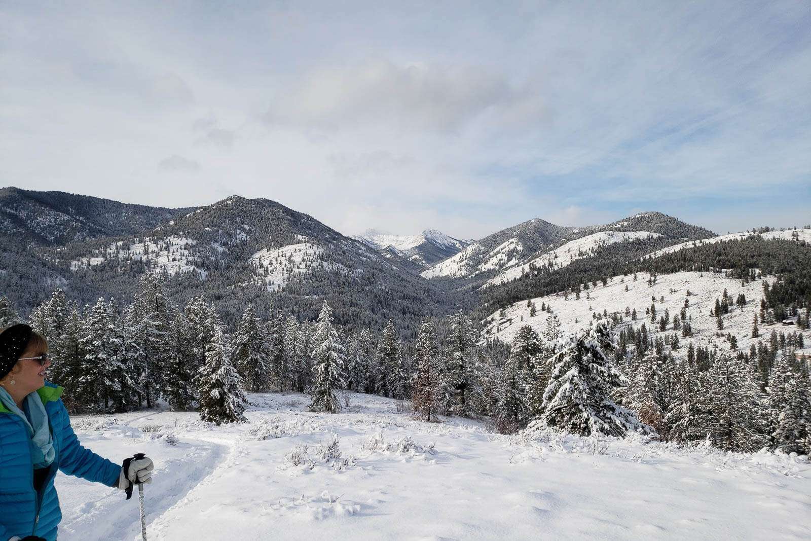
2.8 miles | 690 feet elevation gain
Sun Mountain parking lot, Methow Valley snowshoe pass
Difficulty level: Moderate
Winter outdoor enthusiasts pilgrimage to the Methow Valley for its trail infrastructure and the outstanding beauty of its rugged landscapes. Sun Mountain Lodge, voted one of the top snowshoe destinations for couples by Snowshoe Magazine, has an array of trails for guests and day trippers alike. The Sun Mountain Snowshoe Loop connects the Moose, Black Bear, and Clic-A-Pic trails. Although the trails are marked by flags, sometimes they take work to find on snowy days. You can purchase Methow Valley snowshoe passes at the lodge.
June Lake, Mount St. Helens
4.8 miles | 500 feet elevation gain
Marble Mountain Sno-Park, Sno-Parks permit required
Difficulty level: Moderate
Options abound for snowshoers at the Marble Mountain Sno-Park in Gifford Pinchot National Forest, which boasts 50 miles of trails. Of the choices, June Lake is an especially scenic snowshoe trail for a winter ramble. You’ll follow a trail on a forested creek with excellent Mount St. Helens views. At June Lake, a 40-foot icicled waterfall cascades near the shore. Opt for the trail instead of the faster road alternative to avoid sharing the path with snowmobilers. The trail is well-marked with blue diamonds. Note this area can be crowded on beautiful winter weekends.
Mazama Ridge, Mount Rainier
6 miles | 900 feet elevation gain
Paradise parking lot, National Park Pass required
Difficulty level: Moderate
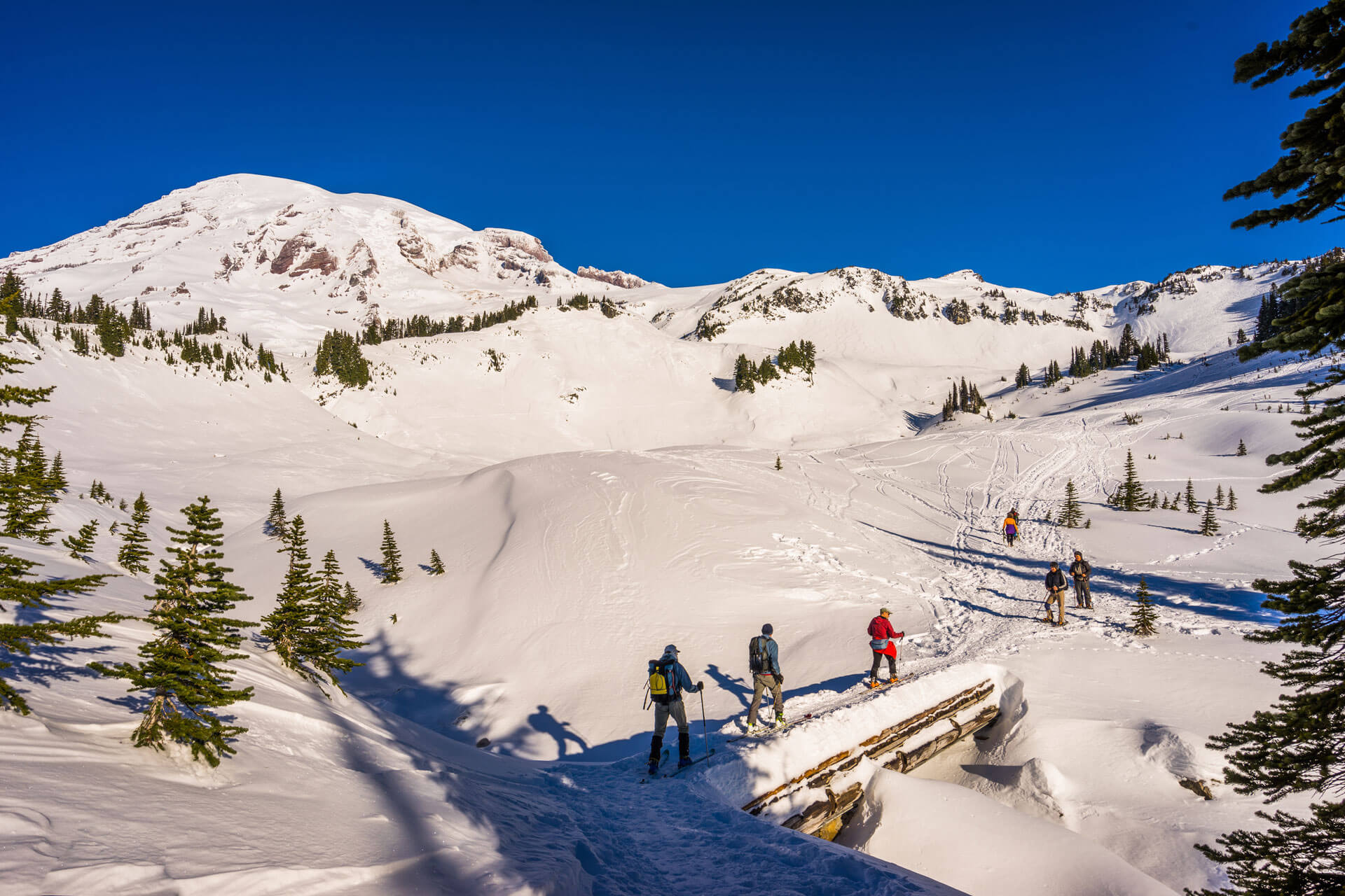
This intermediate-level snowshoe trail takes you through snow-covered alpine meadows with panoramic views of Mount Rainier and the Tatoosh Range. To avoid avalanche danger, park rangers recommend taking the Paradise Valley Road to the 4th Crossing route. Head over the Edith Creek footbridge above scenic Myrtle Falls before continuing east across the upper area of Paradise Valley towards Mazama Ridge and stellar views.
Travel Tip: If driving, the park requires vehicles to carry chains from Nov. 1 through March 1.
Mount Spokane Summit Route, Spokane
4 miles | 1,330 feet elevation gain
Mount Spokane State Park, Sno-Parks permit required
Difficulty level: Difficult
This short out-and-back climb heads straight to the Mount Spokane summit, giving snowshoers the satisfaction of bagging a peak in the Selkirk Mountain Range. Those visiting on a weekend can reward themselves with a cup of hot cocoa from the concession stand at the top. If peak bagging is not your thing, there are many other trail options, including Mount Kit Carson Loop Road.
Know Before You Go
While winter is an excellent time to revel in the outdoors, the season also requires extra safety precautions. Before heading out to one of these scenic snowshoe trails, be sure to:
- Check the Northwest Avalanche Center website for avalanche forecasts.
- Call the ranger district to ask about trail conditions and bypasses, and make sure you have matching route-finding skills for your chosen trek.
- Check road conditions on the Washington Department of Transportation’s website, which has an interactive map.
- Along with a hard copy map of the use area and plenty of water and food, be sure to bring a waterproof layer and an extra warm layer in your pack, as weather can change quickly in the mountains.
About the Author
Ellee Thalheimer is a freelance writer and guidebook author based in the Pacific Northwest who has contributed to publications like Lonely Planet Guidebooks, Alaska Airlines Magazine, and Adventure Cyclist Magazine. When she can’t get outside, she writes fiction, drinks local IPAs, and perfects her handstands.
